No rain, low water levels slow grain transportation
October 13, 2022
Mississippi River constrains food supply chain.
All the major river basins that flow into the Mississippi River and drain into the Gulf of Mexico — Upper Mississippi, Missouri, Ohio, Tennessee, and Arkansas – have been experiencing “severe rainfall deficits over the recent past,” according to meteorologist John Feldt.
 The unusually and extremely low river flows within the Mississippi River drainage basin poses delivery problems and economic costs as the river is a major U.S. navigation and transportation route, especially for grain transport during the fall season.
The Associated Press reported, “At least eight barges ran aground earlier this month due to low water levels.”
The Midwest grain harvest is in full swing. The corn harvest is more than 20% complete, and the soybean harvest is at more than 22%.
The Soy Transportation Coalition estimates that each reduced foot of water depth will result in 5,000 to 6,700 fewer bushels of soybeans being loaded per barge. The effect is staggering when multiplied across the entire soybean harvest.
Barges are navigating the river but loads are far less – and less supply to the market is driving up prices.
According to the U.S. Army Corps of Engineers (USACE), under normal conditions, tows can move 36 barges at a time. Shippers are reluctantly cutting back to 25 barges due to lower river levels.
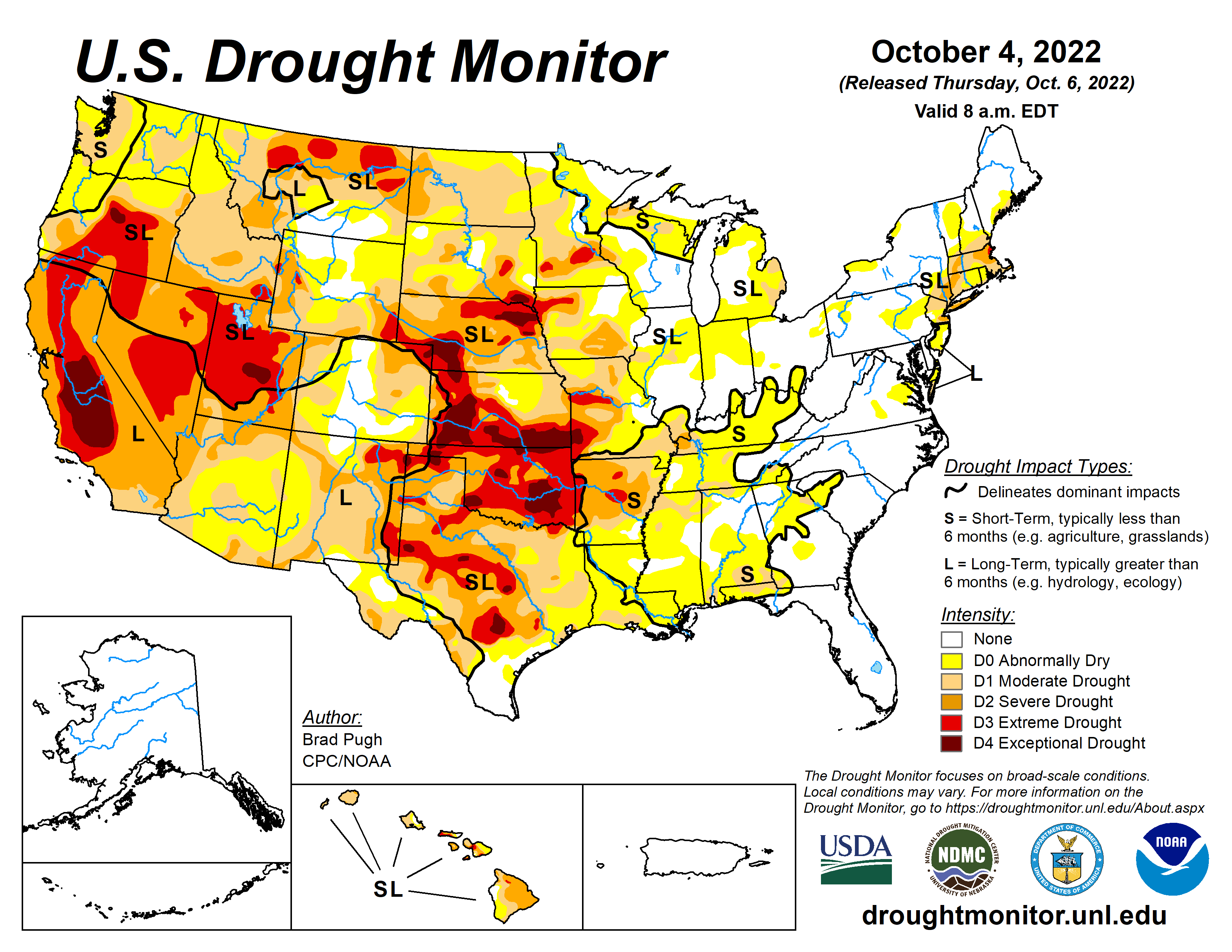
U.S. Drought Monitor maps show that mainly Missouri and Arkansas basins are experiencing either ‘severe’ or ‘extreme drought’ conditions. Feldt notes that other basins are ‘quite dry, but conditions are not severe as inflows into the Mississippi from the west.’
USGS historical duration hydrographs put current flows into historical context.
The black line indicates the current observed river flow. If the river is within a normal range, the black line will align within the green-colored range.
In the duration hydrograph for St. Charles, MO, on the Missouri River, current flow (black line) is more consistently in the below normal range (orange-color) and close to the much below normal range (dark brown).
The duration hydrograph for St. Louis, MO, downstream from St. Charles, shows the stage (or water level) nearing a low flow range as the black line approaches the orange range – rather than staying within the normal range (green).
South of St. Louis, the U.S. Army Corps of Engineers has a gaging site on the lower end of the Ohio River in Cairo, IL at the convergence with the Mississippi. The hydrograph (not shown here) revealed declining gage height since July, 2022, indicating “significantly lower contribution of water into the Mississippi River,” Feldt points out.
With low flows being routed downstream from the Upper Mississippi and reduced inflow from the Ohio River, the Lower Mississippi River is in bad shape.
Vicksburg, MS is even further downstream along the Mississippi River. The above duration hydrograph shows the river at a record low flow level. The black line is in the dark brown color range.
The National Weather Service (NWS) U.S. Seasonal Drought Outlook: 10/1/2022-12/31/2022 anticipates that drought will persist over many critical basins that flow into the Mississippi over the fall months, if not longer.
Below normal precipitation over the Central U.S. region is likely to last through the month of October.
Moreover, a NWS ensemble streamflow plot (ESP) for the Mississippi River at Memphis, TN forecasts the likelihood of very low flows on the Lower Mississippi through most of November, 2022. The mean stage is about 5 ft or lower.
KISTERS supports continuous, real-time monitoring with the provision of water level sensors and precipitation sensors. Reliable, low-maintenance instruments like the open channel water level radar sensors incorporate more than 60 years of experience in engineering design, manufacturing and worldwide deployment.